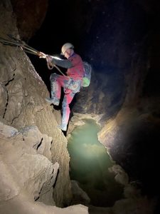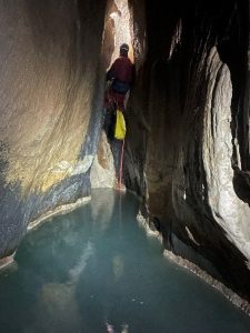
KCC go to Cantabria for 7 (or 9) days: Friday 12th – Friday 19th (or Sunday 21st) April, 2024
Helen, Tom, Scott, Damian, Chris, Rubee, Ray, Vikki, Miranda & John, plus Jim & Sharon (YSS members and friends of Helen)
Report by Helen, with contributions as listed in bold.
In April 2024 10 members of the KCC – Helen, Tom, Scott, Damian, Chris, Rubee, Ray, Vikki, Miranda and John – went to Cantabria for a caving holiday, where they were joined by Jim and Sharon, two of Helen’s friends and members of YSS.
Preparation was relatively straightforward as Helen had caved in Cantabria on 5 previous occasions and had stayed at the ‘chalets’ (2 large houses owned by Casa Tomas in Ogarrio) on several occasions. With various folk unsure as to whether they were joining the trip, we had also booked one of the apartments behind the Casa Tomas bar – ideally located for a quick beer but lacking in hosepipes and washing lines / fences that make the chalets such a good choice.
We carried, between us, enough ropes to allow 2 different groups to complete most of the popular through trips (& Sharon & Jim had brought a whole other set), so we were definitely not lacking in equipment. However, on most days, only one group required ropes and the chosen trips were often equipped with in-situ ropes. [Note: these were of varying quality, and we were quite thankful to have taken our ropes to some venues].
Ray and Vikki had arrived in Spain a week prior to the main party and Scott, for reasons of sustainability, had decided to travel via train and ferry. The remainder of the party met up in the flight queue at Manchester. After an uneventful journey, we arrived in Ogarrio at a sensible time for a quick cave…or beers in the sunshine for most party members…
Friday 12th April:
Ason gorge exploratory afternoon
Almost the whole posse (less ably led by Helen)
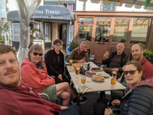
The team from the 2 chalets de-camped pretty swiftly to the bar at Casa Tomas, where Ray and Vikki had been waiting for our arrival—it was, after all, a glorious afternoon. Meanwhile, Sharon and Jim (staying in the apartment with Helen), disappeared to repeat a much-loved classic—the Coventosa trip to the streamway and up to the first lake (where boats become a necessity).
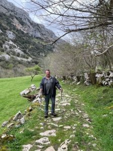
More beer, or a swift cave, was the option for the remainder of us…and surprisingly, when I suggested that we visit Cueva del Escalón, a cave near Coventosa, as it was a nice, easy walking trip that would provide a suitable introduction to caving in the area, the caving option appealed. So we also headed up the Ason valley to the parking place (take the right immediately before the bridge which wends up the valley side to a small hamlet) and had a beautiful walk along a low level trail to arrive at what I thought was the entrance to Cueva Escalón (oh, the fallibility of memory after a break of 4 years from Cantabrian caving trips!). It wasn’t Escalón, but we were able to get briefly underground—which was warranted in the heat. After a little more searching we did indeed find the entrance to Cueva Escalón only to find that it had been blocked off with a wall containing a door across the entrance, surrounded by a high fence topped with barbed wire. Tom informed us that it had been taken over by a group called Astroland to use as a training camp for would-be Mars explorers (!!)
Cuveva Coventosa entrance series
Helen, Miranda, John, Tom, Rubee, Damian, Chris, Scott, Vikki, Ray
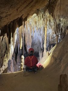
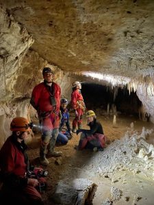
After an inauspicious start to our first caving trip, we retreated to Coventosa—where a jet of cold air and huge entrance left no room for mistakes. We spent about 45 minutes exploring to the head of the first pitch and to the very well-decorated entrance series that is normally passed by if heading down the pitch to Sala de los Fantasmas. (Head straight on down a long slope and bear right at the bottom into a very large chamber with a stunning array of formations). This trip is also a possibility for injured cavers – as demonstrated by Damian heroically completing the tour using 2 walking poles!
Cueva Coventosa to lake
Jim, Sharon
We repeated a route we had done previously as far as the lakes. But took the muddy slide rather than the pitch on the way down. [HH edit: this can be found by going right from bottom of the first pitch (facing out), past the pitch up to the usual through trip route and continuing along till a hole appears at the base of the LH wall]. This isn’t recommended as no rope was in place and it’s now quite serious. Better to go via the main route using the up pitch and the knotted hand lines down. We made our way to the lake. Some new wires were in place on the traverses, which made things a bit easier.
[HH note: They arrived back reasonably late and so the week started for me as it was destined to continue—cooking tea and waiting to receive an ‘out safe’ message before indulging in a glass of wine!]
It is worth mentioning here that a nomination attempt for next year’s Cock Up Ken did occur on this first evening. Miranda, John, Chris and Damian had inadvertently shut their chalet door leaving the keys still inside. The chalets used to be relatively easy to get into without a key (!) however, in response to complaints from some guests, Casa Tomas had removed the means of easy access. Much beer had been imbibed at the bar and it was only on return that the discovery was made that no-one had picked up the key. So, in the middle of the night, none too pleased help arrived from Casa Tomas and the back door was duly crowbarred open to let 4 KCC cavers reach their beds. [Having said they were none too pleased, no charges were added to our bill. Thanks Casa Tomas].
Saturday 13th April 2024:
Three trips took place on our first full day in Cantabria:
Cueva Narizon to Torca Paloma:
Jim, Sharon, Helen
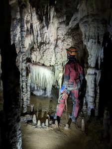
An excellent through trip with amazing formations. Took us about four hours after waiting an inordinate time for Jim to sort work and holiday rental problems. Was this becoming a theme? (Jim & Sharon undertaking long trips but starting very late in the day?) After a delayed start, we drove to the cave (on the northern coast by Castro Urdiales) and waited another 2 hours for Jim to finish wrangling with customers – in 28-degree temperatures with no shade. Sharon and I bided our time by rigging the exit pitch from Torca Paloma which was found easily by walking 100m down the road to a well-trodden path on the right, leading up through eucalyptus trees to a massive open pot. Of note: on our exit from the cave, the anchor that had been in situ had been removed and our ropes re-rigged to a tree belay. This proved perfectly adequate although it may be a good idea to take an anchor with you to rig this pitch. The formations were superb throughout and route finding generally straightforward, although Helen’s dodgy knee was not appreciative of the crawling that characterised progress through most of the cave. Ropes (of varying quality) were in situ throughout, so it is only necessary to rig the exit pitch). A definite recommendation for any future trips.
Cueva Cañuela
Tom, Rubee, John, Miranda, Chris, Scott, Vikki, Ray. (Photographs: Chris Hunter).
Vikki and I had taken a sneaky look into this one a couple of days earlier and were keen to get to the supposedly huge chamber (Sala Olivier Guillaume) that marked the end of a typical “bottom entrance” trip. This is where the final pitch from Sima Tonio drops in on the traverse. The plan was for Scott, Vikki & me to forge on ahead, while the others explored the Canon Oeste (without climbing the pitch up into El Bulevar).
From our experience a few days earlier, Vikki & I knew there was really only one good parking spot and it could accommodate 2 cars. Ideal, as we had 2 cars! Well, it would have been ideal if the area hadn’t been flooded with spectators for some sort of car rallying event. Still, we managed to squeeze one car into the perfect spot. The others had to park somewhere further towards Bustablado.
For reference, the walk to the entrance starts at a lane off to the left of the minor road to Bustablado, almost exactly 1km from the junction with the main road from Arredondo. It may be possible to park a single car at the start of this lane, but we weren’t brave enough for this. Our ideal parking spot is a small layby, maybe 200-300m before this lane, again on the left as you drive towards Bustablado. [HH edit: I have parked at the end of this lane on 2 previous occasions—it is possible!]
The lane starts downhill and soon crosses the river on a good bridge, before swinging round to the left and rising gently on the edge of the trees. As you progress, you will note an obvious cliff high up to the right. The entrance is not at this cliff. You need to stay lower and traverse further round beyond the cliff before climbing up to the entrance. At one point the good path you’re on disappears. Stay on the same heading up through a field and you’ll pick the path up again soon as you enter trees again. Essentially just stay on this path until you break out into a wide, grassy (and steep and muddy!) shallow gully that leads up to the huge entrance. You will probably note the cool cave air pouring down this gully. Follow it upwards!
The walk up was made more interesting by the fact that the locals had decided to set fires to burn off bracken (presumably) quite high up on the mountain-sides, so there was a tang of smoke as we walked up the hill; we decided that if the cave was drawing in air, we wouldn’t enter it, but given the powerful outwards draught we decided that it would be safe to go in. [Edit HH: This was the day that forest fires engulfed the hillside—they were still burning for a few days. We were slightly worried about the Cañuela trip cavers!]
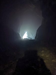
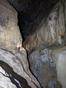
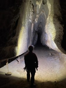
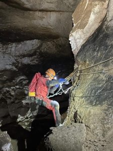
The entrance is truly awe inspiring. The cave is GINORMOUS – a large entrance leads to a passage maybe 15–20 metres wide and even higher. The scale of it has to be seen to be believed. We all set off together down the huge passage for a few hundred metres, where a long, roped traverse along the LH wall must be negotiated. This traverse is easy enough and was equipped with 2 fixed ropes for our visit. “Easy” is, of course, a relative concept. Rubee may choose to disagree… which makes her successful negotiation of this obstacle all the more impressive.
Once across the traverse, Scott, Vikki and I parted company with the rest of the group, who followed along at a more relaxed pace. The huge passage continues with few obstacles. There is a short handline climb up (2m or so) at one point. Eventually the pitch up into El Bulevar (and the further reaches of the cave) appears up to the LHS. This was easily identified in our case as there was a fixed rope going up. Shortly before this, the passage goes round a significant RH bend with what looks like it could be a pitch up in the LH corner. This is not the actual pitch!
If the pitch is not rigged, there is apparently a bypass via the “catflaps” just a bit further along the main passage. We didn’t look at the bypass, so can’t vouch for it in any way.
As planned, the rest of our party didn’t climb the pitch, instead carrying on along the main passage, which continues, apparently in fine style, as Canon Oeste. John, Miranda, Chris, Tom and Rubee continued through more of the big stuff. [John] After some time the others decided to call it a day, and I continued alone until I reached the end of this particular passage (well I think I did, but I didn’t look in every nook and cranny to prove it). We then turned back and were out after about 2 hours 40 minutes underground.
The pitch is apparently around 15m, but the bottom section is up sloping calcite, so there’s only a relatively short vertical section. At the top is a rebelay, made slightly more awkward (for us) by there being too many ropes for the short top section.
At the top of the pitch is El Bulevar, particularly pleasant and easy going in large passage with a flat floor. At the end of El Bulevar is a series of climbs down, again equipped with a fixed rope for our visit. Route finding to this point is pretty easy (as long as you find the up pitch into El Bulevar). It now gets a little bit more tricky and we found a compass and survey to be indispensable. One problem with the survey we had is that it shows all passages in the same yellow colour, so it’s difficult to know which passages are at which levels. There are quite a few piles of stones and reflectors to aid navigation, although the reflectors are really there to show the way out of Canuela from Tonio. Basically, if you haven’t seen a reflector or pile of stones for a while then consider turning round.
From the bottom of the climb down out of El Bulevar, the key is to climb/traverse high up to the LHS into the continuation of the higher level passage, rather than follow the obvious slope down to the right. Vikki and I followed this slope down on our first visit. At the bottom we were unknowingly turned round through 180 degrees to climb back up into territory that looked increasingly familiar!
Once in the continuation of the high level passage, avoid heading down a long slope to the right. Soon the passage forks. The way on to Sala Olivier Guillaume is the RH branch, but it’s worth taking a brief detour to the left, down to Galeria de las Sierras with its many hanging “swords”. Take the LH branch from the previously mentioned fork. Before long the passage starts to head down a slope and forks again. Head down to the right here for Galeria de las Sierras. Just keep heading down slope and marvel at the many sword-like stalactites. The passage eventually ends at a sump and the sound of running water below boulders. On the way back up, note that there is a higher-level passageway up to your left. You will soon be up there.
Back at the 1st fork, turn left (i.e. the RH branch as you head into the cave). Before long you arrive at a deep hole in the floor. You want to traverse and climb down to the LHS of this. There was another fixed rope here for our trip. A short descent brings you to a ledge at the top of another deep hole, which you were previously at the bottom of if you visited Galeria de las Sierras. Traverse the ledge easily around the RHS of this hole and follow the obvious passage through Galeria del 10 de Agosto. Route finding isn’t too hard – just keep heading south and following any markers you see.
Eventually the passage starts to climb at La Antesala. This is the final climb up into Sala Olivier Guillaume. Keep heading up until you come to a 4m pitch up, which will hopefully have a fixed rope – it did for us. At the top of this pitch, the passage soon opens up into the vast Sala Olivier Guillaume. It’s hard to take in the full scale of this chamber, mostly as it’s filled with a mountain of rubble, up which you are constantly climbing. We stayed close to the RHS as we climbed up. Vikki and I stopped somewhere short of the true summit, Scott carried on. We reckoned the climb up from the low point in La Antesala to the summit is just a bit short of 200m vertically!
Perhaps unsurprisingly, Scott got disoriented at the summit and started to head down the wrong side. Luckily our lights were able to guide him back down to us. Although we felt a long way from home as we set off out, the return trip went much faster than we expected. For one thing, route finding was much easier, partly due to all the lovely reflectors to follow. Before long we were slip-sliding back down the gully leading from the entrance. Once out of the gully (and the cool cave air) things heated up rather quickly.
This is a must-do trip for anyone in the area. Even better, do the traverse from Sima Tonio. Unfortunately, we didn’t get the chance on our trip… but it’s top of my list if I ever go back.
As a postscript, beware the dog that lives in the farm/house between our perfect parking layby and the lane leading to the cave. It isn’t scary/dangerous at all. Quite the reverse – it’s a bit too friendly. We had trouble getting rid of it both on the way to the cave and on the way back to the car.
[HH edit: This dog bit me and drew blood—I would contest the non-dangerous statement!!]
Ason col circular walk: Damian
Having successfully explored the entrance series to Coventosa with the aid of two walking poles, Damian headed off solo to engage in a walk that he described as quite challenging with the odd scramble and very interesting geology. The walk starts from the parking at the col and is well-marked throughout (14 km & 600m of ascent). It was another very hot day so probably a good choice rather than heading underground!
[HH note: this walk is a spectacular option for a non-caving day]
Sunday 14th April 2024
Damian continued his solo exploration of the area with a drive out to Picon Blanco while various other caving, and non-caving exploits took place:
Via ferrata El Cáliz:
Chris, John, Miranda
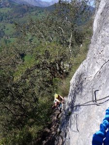
There are several via ferrata in the area, and Miranda, Chris and I decided to do the easiest one, which is situated just outside Ramales. On another glorious day we set off for the VF. There were quite a number of people doing the VF, which did, indeed, turn out to be very easy, but nevertheless got us into some spectacular situations. It climbs a height of 120 m, nearly all of it on hoops. We then spent the rest of the day rather lazily, with tea at the Plaza Bar for the second day on the trot.
Photo: John Forder
Coventosa:
Ray, Vikki, Scott, Helen
This was Vikki’s first SRT outing on the Cantabria trip and progress was cautiously made down the entrance pitch, into Sala de los Fantasmas, up the next pitch and down to the traverses.
When we reached the final traverse before descending to the streamway, Ray and Vikki turned around leaving Scott and me to continue. There have been substantial additions to the in-situ equipment along the streamway route—some useful, others not!
I stopped just before the traverse to the first lake, leaving Scott to continue solo—my knee was hurting after 3 consecutive days of caving.
I really enjoy this trip and it didn’t disappoint. Coming out into sunshine was especially welcome.
Finding Rubicera:
Sharon, Jim
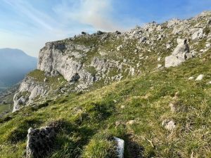
A useful day to locate the entrance! [HH: This was indeed another long Sharon & Jim day & they were exhausted when they eventually returned—but had found the entrance—eventually!] Definitely best to park near the top of the Ason Gorge rather than from Mortero if wanting to do the Rubicera – Mortero through trip. The walk from Mortero was challenging and not recommended!!
Photos by Sharon Rosser. Photo below is of the boulder where you head down to the bottom of the top tier of rocks
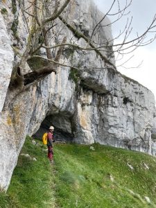
Photo below is the cave entrance
Monday 15th April 2024
Damian and Helen undertook a shopping trip to top up supplies (it’s useful having folk without the capacity to cave every day on a caving trip!) This included Helen’s welly stop at the ferreteria and a farmacia stop for Damian’s blisters and Helen’s dog bite!
Helen had remembered a parking place at Alto Cruz de Usano (the col passed when approaching Matienzo) and we found a circuit on Damian’s app of 5km and 135m of ascent.
This in an area where many of the Matienzo group’s unexplored, possible caves are and we made sure to investigate each of many open potholes and gaps in the limestone pavement.
Cueva Rubicera to Mortero
Sharon, Jim
An amazing through trip with spectacular traverse around the P80. It is possible to avoid the spider traverse in Mortero by wading or swimming through the lake!! Through trip took us 8 1/2 hours. (Photos: Sharon Rosser & Jim Gleave)
Coventosa to the stream and Sala de los Fantasmas
Chris, John, Miranda
After 3 days of glorious sunshine today was dull, with a bit of drizzle, and quite cool.
We descended the pitch that leads off to the Sala de los Fantasmas (to the left with your back to the pitch) and set off in the opposite direction towards the streamway. This involved a modest amount of pitch work on in-situ ropes, and quite a bit of traversing on fixed ropes and/or thick steel cables, mainly quite easy, though on occasion a bit tricky. We reached an area of gours and deep pools, with a small stream running through, but didn’t proceed very far before going back to the Fantasmas, returning to the surface after about 4½ hours underground.
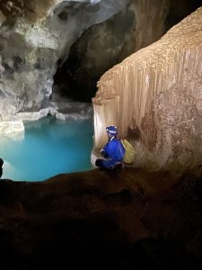
(Photo: Sala de los Fantasmas John Forder)
Red del Silencio
Ray, Vikki, Scott, Tom
Cueva Del Valle as far as La Playa. Return.
Tuesday 16th April 2024
Cueva de Cullalvera (show cave)
Damian, John, Miranda, Chris, Vikki
This was another grey, dull day with drizzle on and off, and so we decided to visit the show cave Cueva de Cullalvera, which is situated quite close to the centre of Ramales. The cave was rather disappointing, consisting of a single large passage with a few formations high up in the roof, though apparently it actually goes for 12 km.
Cuivo-Mortero
Helen, Scott, Tom
Found the entrance much more quickly than on previous visits! (Maybe spurred onwards by the drizzly weather). There was a very old and frayed traverse line to first PT—across a wide rift in descent – so I rigged a retrievable PT—but, having accepted a suggestion for a simpler way of rigging involving changing the knot at the Y hang anchors rather than pulling all ropes up again, the wrong rope was sent to the bottom. This I realised on my descent which ended in a loop about 2m from the floor! Reascended and sorted, but this mess up, and my hobbling, meant that the trip took us 6h45 rather than documented 5h for my previous trips.
A big disappointment for me was that there was no sign of the fire salamanders that have previously been abundant directly under the entrance pitch. I assumed that this was due to the inclement weather, but it appears that salamanders are often more active on wet days. Maybe the population has deceased? (There really can’t be sufficient food under a cave entrance pitch to feed a large family).
The cave was also much wetter than I remembered! We traversed and waded (& sometimes fell into) pools for what seemed an incredibly long time and we were all pretty hypothermic by the halfway point. I had to cut my rope on the 37m pitch as it got stuck somewhere halfway through the pull down and we were too cold to effectively solve the problem. Thankfully this was the longest pitch, so there were no ongoing issues (& the rope was well past it’s sell-by date anyway).
Exited into sunshine at Mortero and, by the time we were back at the car and feeling warmer, the near-hypothermia had been forgotten. An excellent trip.
Red del Silencio: Middle Entrance (Torca de la Canal) to Valle
Sharon, Jim
There are tight crawls and an awkward rift at the middle entrance, but worth it for the formations and through trip to Valle.
Middle entrance to The Book took us 45 minutes. The Book to La Playa took three hours and La Playa to Valley 1.5 – 2 hours.
[HH: This now completes, although not in one sitting, Sharon and Jim’s exploration of Red Del—having previously completed the top to middle entrance and explored for a couple of hours at the lower, Valle, entrance].
Wednesday 17th April 2024
Damian, Helen (& Ray for lunch)
Damian and Helen set out dreaming of nice salad and chips lunch at the Bar Coventosa in Ason, but this, and every decent looking bar was closed, so we ended with a dodgy sandwich in a less salubrious Arredondo bar—the only one open.
However, it still felt a bit decadent. We all tried the local white wine which turned out to be a cross between antiseptic and sherry—definitely NOT recommended.
In the afternoon, Damian and Helen headed up the Ason valley, following trails from Old Ason (6.5 km & 202m of ascent) reaching the base of the waterfall. (Well almost, we decided that the final 50m ascent through boulders was a step too far for our various injuries!) It was a lovely walk for those with dodgy knees or those wanting a restful day enjoying the tranquillity of the Ason valley.
Gandara
Sharon, Jim
Gandara to Salle Angel return. We met the team from SWCC at the Salle Angel Chamber, where there are great helictites.
We turned round at the ledge and near the waterfall in the Salle Angel chamber. Took 4.5 hours.
Cueva de Vallina through trip
Chris, Scott, Tom, John, Miranda, Vikki
We decided to do a through-trip from the original (Top) entrance to the Lost Pot entrance of Vallina. On another grey dull damp day, it was quite a relief to get underground. The entrance consists of quite a large opening, which closes down to a silly little tube that can, apparently, sump off. It is not very long however, and immediately on the other side of the crawl it opens out a bit and then there is a pitch of ~10 m.
After that the passage is mainly large until you arrive at a split pitch of ~12 m and 25m, where the passage gets a bit smaller. After a short distance there is another 12m pitch quite close to the Lost Pot Entrance. From here the passage is mainly of much smaller dimensions (though mainly walking). The trip went well, with only minor route-finding problems, and we emerged to a continuing dull day after about 3½ hours underground.
Thursday 18th April 2024
Another Vallina through trip: Top entrance Lost Pot entrance.
Sharon, Jim
A great little through trip took us three hours underground. Lots of interest. We briefly followed the route to new lower series before coming out of Lost Pot. [Slightly beating the time of the previous larger trip! I’m slightly jealous as this was a trip I wanted to repeat, being mainly walking and thus ok for my knee, but, given that the majority of KCC had already undertaken the trip, a Gandara lower entrance explore seemed on the cards].
Cueva de Gándara: lower entrance to Salle Angel pitch head
Miranda, John, Vikki, Helen, Scott, Tom
Thursday was another dreary, damp and cool day – another good day for getting underground! Scott, Vikki, Tom, Helen, Miranda and I set off (on Helen’s recommendation) for Cueva de Gándara, which is situated not far from the road at the top of the Asón Gorge. In some respects, this cave was similar to Cañuela, in that the part we visited was only a small section of a much bigger cave developed on different levels; it was also similar in that it started as a big passage with a traverse round the left-hand wall (going in).
[HH note: John seems to have left out the fact that both he and Miranda managed to set off rock falls by opting for alternative routes down the blocky slope showing how unstable it has become at the top after the recent-ish rockfall that has significantly expanded the entrance to this cave and strewn further blocks on the descent route—take care!! My knee had become progressively worse during the week and I opted to for a Damian-style, 2 walking pole descent of the initial slope to the traverse. Each time I visit, the traverse seems more polished and the in situ ropes less confidence-inspiring!].
It differed from Cañuela in that there were some smaller passages off to one side of the main passage. In fact, we actually found ourselves crawling at one point, though it was possibly the easiest crawl I’ve ever done, through a nicely shaped tube that in fact was more stooping with a bit of hands-&-knees stuff, with a floor of clean dry sand. Beyond the ‘crawl’ the passage enlarged again and there were some nice formations (albeit they were a bit dry). We turned back near a 60 m pitch to a lower level [HH: Salle Ange pitch—only Scott made it to the pitch head], and were out to a dull, murky afternoon after about 3¼ hours underground.
The Solo Adventures of Chris (with Damian for moral support): The search for Shaft 2967
Photos and text by Chris Hunter. Damian, who was mainly concerned with totting up his mileage seemed less enthusiastic (!) and writes: Cave hunting with Chris in the pissing rain! 6km and 270m of ascent.
Every year the Matienzo expedition publishes a hit list of sites which need revisiting. When we were over there in August 2023 one of the sites, 2967, described as a 10m x 3m x 10m deep shaft sounded interesting and we thought we would have a look at it. However, during that visit we never quite got to it as it is quite remote and other things were easier to access.
Not getting to it last time left me with a feeling of unfinished business and Damian was up for a walk so on a very wet day we set off for a look. With a decent SUV hire car Damian was able to drive quite a long way up the track that leads to the site until we were defeated by a steep rock and gravel section, conveniently there was space to park at on a hairpin at the bottom of that section. From there a 3km up and down walk, but mainly up, in the rain got us to a point where we had to leave the track and climb up the hill. At this point Damian, who was struggling with a shoulder injury, decided he didn’t want to risk the rough karst terrain and headed back to the car. I found a point where I could climb up from the track to hill side and set off over the tricky terrain.
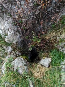
On the way I found site 2061 by accident so went for a look, clearly at one time this would have been a decent cave and may be worth investigation.
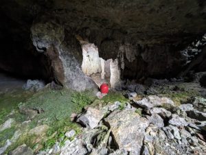
View inside Cave 2061 showing stal columns:
The GPS showed about 400m from the track to site 2967 in a straight line but lots of shake holes and depressions meant that a straight line wasn’t possible. In thick mist and rain navigation proved interesting, but after a bit of slog I got to the right area which was a large steep sided valley with a number of depressions around the edge, one of those would contain 2967. The mist was starting to clear, and it didn’t take long to find the correct shake hole and in the side was a nice clean-washed shaft.
I had taken my SRT kit, a 12m rope and a couple of slings so I rigged off a bush and a block at the top of the shaft which after a good kicking seemed to be attached. A note for next time is to take some rope protectors because getting a rub-free hang was not possible. At about this time it occurred to me that whilst people generally knew where I was, I hadn’t left the exact location with anyone but I was here now so I with a little apprehension dropped the shaft.
As expected, it was choked at the bottom but was taking a dribble of water and there was a faint draught.
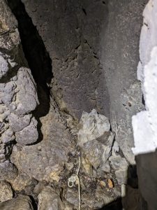
The bottom of the shaft:
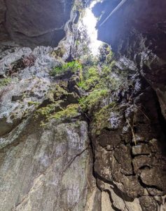
Looking up the shaft:
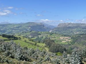
On the way back the rain stopped, and the sun came out so, despite soggy boots, it was a pleasant walk back to the track. However, the track is cut into the hillside and has a 10 foot drop along a lot of its length, so finding a point to drop down meant some pretty unpleasant scrambling along the edge of the track. Having dropped down it was a slog back to the car with some nice views out to the coast.
After returning to Ogarrio, we settled up with Casa Tomas and the obligatory beer. It wasn’t sunny as at the beginning of the week but the huge amounts of tapas that arrived on our table meant that we summoned the wherewithal to brave the inclement weather for a while longer.
This more than sufficed as the starter for our final group meal at the Restaurant El Puente near Ramales.
Friday 19th April 2024
Ray, Vikki, Helen, Tom, Sharon and Jim bid farewell to Ogarrio and headed home. It was an early start and there was a fabulous sunrise (that I incompetently tried to capture—so not included here!)
Short of luggage space, and feeling the effects of 5 days of caving, I decided to wear my monstrous knee brace. Unfortunately, it did not fit under my legwear and so was highly visible…so much so that I was moved to the ‘needs assistance’ priority queue at Manchester passport control and was able to take Ray along with me (who was also hobbling). A small positive in terms of knee injuries and caving trips!
Meanwhile, back in Cantabria Damian completed another solo adventure:
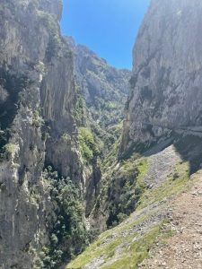
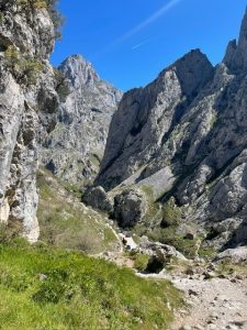
After undertaking the several hour drive to the Picos, he completed the Cares Gorge Walk – his photos tell it all. (23km & 566m of ascent):
Chris, John, Miranda and Scott went for a pleasant walk in a shady forest up to a meadow, then came down again! Then went for a drive to Matienzo and visited Cueva de la Cosas.
Saturday 20th April 2024
Damian, John and Miranda completed a loop around Ogarrio. Lovely 7.5km with a bit of uphill (230m in total)
Chris and Scott: A drive up Picon Blanco followed by a poke around the area at the head of the Ason gorge.
All: A visit to Cueva del Agua and a drink in Matienzo.
Sunday 21st April 2024
Later flights allowed those returning on Sunday to check out other places on the drive to Bilbao:
Damian drove to the El Suceso hamlet and walked partway up Armanon:
From Armanon looking west towards the Picos (Photo: Damian Teal)
And so ends the KCC diary of caving (& other) events in Cantabria, Northern Spain in April 2024. We had a mix of weather, but enough sunshine to make us feel as though we had come to Spain. We barely touched the surface of possible caving opportunities and perhaps, with a less injured party on our next trip, we will be able to complete more of the famous through trips…or join Chris on his search for unexplored openings in limestone pavements.
Possible date for next trip: April 2026.
