Grotte de Midroi
Day 6, Ardèche Trip – Midroi/Rochas/Guigonne
Team: Will, Kate, Damian, Maz, Jasmine & Scott
You may have noticed from the Ardèche reports that we are missing days 4 & 5. Kate and myself have been road tripping this holiday in our van and splintered off from the rest of the group for a couple of days to take a very slow and scenic drive through the Gorges de l’Ardeche and to take Lenny for his ‘return to the UK’ appointment with a French vet. The others caved on both days, trying a couple of different routes into Foussoubie on one day and Champclos on another -you’ll have to await the reports and images from someone else I’m afraid!
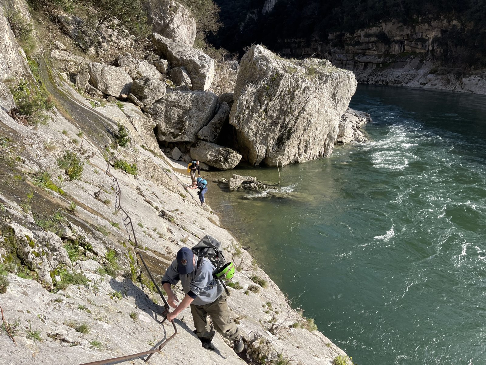
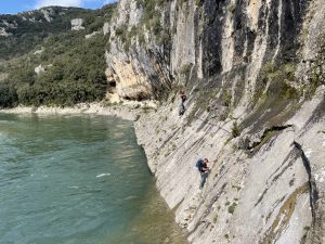
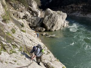
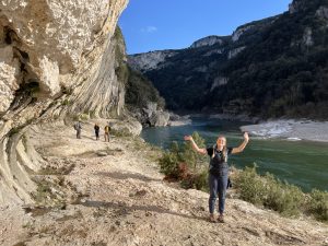
Whilst travelling through the gorges, Kate and I saw that we were going to pass the area of Midroi-Rochas-Guigonne, the fifth largest system at 7700m of passageway and the deepest trip around 175m. Rochas is the vertical side of the cave, where you can do the through trip, however it is essential (as you’ll see further in this report!) to ensure that water levels are low enough for the connection to be made as it is a crawl that can become flooded. Midroi is the more common horizontal entrance and Guigonne is another along with vers les Aments, however I’m not sure if either of these last 2 are passable for cavers at all, potentially Guigonne gets wet towards the exit from looking at the survey. With what is described in many reports as an interesting and challenging hike in/out, Kate and I loaded up and head out with Lenny on a recce mission. After some serious descent down a single track that we knew would be brutal to hike back up (not too brutal though as we ended up doing it two days in a row!), it wasn’t long before we were passing through Refuge de Gournier in the bottom of the valley and onwards to the Great Gour. This is a limestone pavement carved into the bottom of the cliff that gives you a nice walk above river level, before becoming steeper and iron handrails introduced to help the scramble across at the end. Just before the end of the scramble, the way on slants off to river level, and we were unable to continue due to not having wellies and the river levels being pretty high – at this point, you must step into the violently flowing Ardèche river with not many holds at all and hope the water doesn’t carry you off! As we had Lenny, and neither of us had wellies, this was were we turned around although unknowingly we were only a couple of hundred metres or so from the Midroi entrance. We regathered Lenny, he was tethered to a small shrub on the Grand Gour whilst we looked at the traverse, and then began our hike back out up the valley. We planned to return on the next day with the rest of the team to try again.
We were a little kit heavy as we had a tackle bag with ropes and crabs, and another with the emergency kit and an additional bit of rope just in case (we were learning from our previous outings!). Due to the hike in and out, all but Jasmine opted to hike in clothing and change into cave kit river side. Kate was feeling brave enough to join us for her first KCC trip, and she instantly proved her worth carrying her own kit and the rescue kit all the way, and juggling 2 bags along the traverse – I had the other 2 bags. We’d discussed bringing the S.S.Gournier also, but as we’d already packed the ropes to traverse le Grand Lac, we opted to leave it as a) it was additional kit to carry in and out, and negotiate across the traverse, and b) it may be required again before the end of the holiday! Hint, hint! (Where was it last used?) A wise decision definitely, as the hike back out is not the most pleasant, but this is where I proved my worth and loaded up with my bag, kit bag, and rescue bag to give the others a bit of relief on the way up! Kate often refers to me as her ‘mountain Yak’! Damian had volunteered to be our call out and not cave, but joined us on our hike in and then he continued along the river bank whilst we were entertaining ourselves.
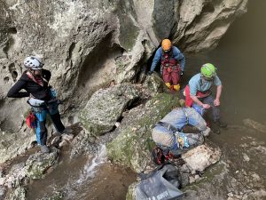
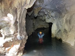
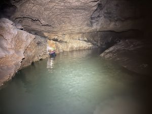
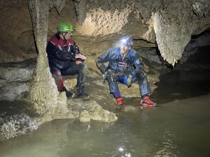
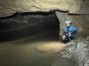
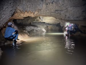
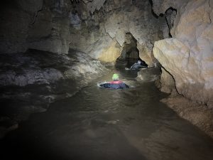
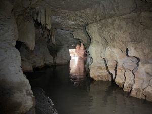
The weather was lovely, and the walk in was quickly accomplished, finding ourselves on the Grand Gour in no time gearing up for the traverse that turned Kate and I away the day prior. It was immediately obvious that, overnight, river levels had dropped some what and the crossing wasn’t looking anywhere near as treacherous as the day before! The team all made light work of the crossing, and quickly scrambled between the boulders to gain the shore on the other side. Following the various descriptions we had, it wasn’t long before we found a large entrance that we thought to be Midroi, only one issue, totally flooded waist to chest deep from the get go. Jasmine was super keen and donning a wetsuit, so she was nominated/volunteered and took off into the flooded entrance, fully swimming from 10/15 metres in. It wasn’t long before she returned to inform us that the ceiling becomes very low and sump’s not far in. Surely this can’t be Midroi?! Where is the the Grand Lac?! Where are the ridiculous number of bolt/anchors along the right wall to traverse the Grand Lac?! Surely this can’t really be that flooded?! As we quickly revised the descriptions again, looking for any key detail we may have missed, we were certain this must be the place. Some previous trips from other clubs reported that they found the cave to be sumped and had to retreat, but all had spoke of finding the Grand Lac not far inside the entrance, its supposedly some 30m across and can be crossed by swimming, by boat, or by rigging a ridiculously long traverse along the right hand side – which being the rope geek I am I opted for! A few descriptions had said it can be difficult to spot the entrance to Midroi (which we hadn’t experienced) and that it was 250m from the end of the iron handrails at the boulder, and at an elevation of 85m. Scott, Maz and I set off back retracing our steps to pace out the distance, and scour the side of the cliff for any other possibilities. Luckily, I had my Garmin watch on so could very accurately walk 250m then climb to exactly 85m in that location, although it did take me about an hour before realising! After almost 2 hours, we’d found nothing at all and had searched from the start of the boulder, right along the shore to around 350/400m and up to an elevation of 95m. There was only the one entrance, it had to be this. As I returned, I’d found the others already back together, and whilst we were away Jasmine and tried to dig out around the large boulders at the entrance that were causing a dam. Actually, she’d made some really good progress and looking along the walls inside the cave you could see it had dropped around a foot whilst we’d been out searching. After some further digging with the aid of Scott and Maz, Jasmine again set off inside to see if we could make more progress. Keen to wash my oversuit from the previous trips and being teased by Kate with the “if you will I will” phrase, I followed, and then the others followed me. We all made it roughly around 100m, getting fully drenched, before the passageway splits with a high level branching off to the left that quickly becomes a crawl and didn’t look like it went very far, with the lower level leading onwards into a smaller passageway. Before now it was possible to avoid swimming, but the floor of the cave was so slippy with mud/silt that it was impossible to hold your footing and you may as well swim! From here on, the water temperature changed and you could tell it was much deeper, and unable to touch the bottom. On Jasmine’s first swim in, this way on was almost flooded to the ceiling, leaving only a couple of inches air space at the top, and as she was already fully swimming with no knowledge of the bottom Jasmine opted to retreat to us and no push into the space – a wise choice as only a couple of metres inside and it was fully sumped. When we all returned together, the water here had dropped around a foot and a half and again Jasmine swam over this time into the opening, whilst I’d scrambled around the edge in an attempt to remain somewhat dry to support her onward attempts with words of wisdom. Again, still sumped. We retreated a little and explored what we could before exiting for another change riverside followed by the hike back out. Damian was ahead of us making it back to the vehicles first and kindly waited to ensure we all got back safely. It must have been some sight for him on his return down the river to where he’d left us, as the Midroi entrance was promptly spewing out cave water that’s been trapped for who knows how long, down and along the river bank into the stunningly coloured Ardèche river!
As we were walking back through the Refuge de Gournier, Maz took some time to explore and reminisce on his years here with groups as a teacher. He found some information boards, and wooden markers to indicate the previous flood levels, some very recently. Everything suddenly made sense! It’s no secret that the Ardèche floods through winter, in fact on this exact trip at the end of March we’d experienced some horrific rain when travelling over and in the first few days, so knew the water levels were up. Where Maz was now stood, holding his hand above his head saying “this is where it flooded in 19** and here in 18**” we were probably about 10 metres ish above the Grand Gour and in turn also above the level of the entrance to Midroi. So when this area floods, and it doesn’t need to be catastrophic, the traverse on the Grand Gour (and probably the Gour itself!) completely disappears. The entrance to Midroi will flood and sump to the ceiling, washing in a load of sand, silt, and flood debris carried down the river. When the levels drop, the Midroi remains completely flooded until the entrance has had a good old digging out to make it somewhat friendly again before normal service can resume in the active months, maybe by a local speleology club or guides that use the cave? Perhaps they’ll be relieved this year to see that, thanks to Jasmine and other KCC helpers, the works already been started! We certainly need to visit again in peak season to see if our theories are correct.
Write up and pics by Will

Leave a Reply
You must be logged in to post a comment.